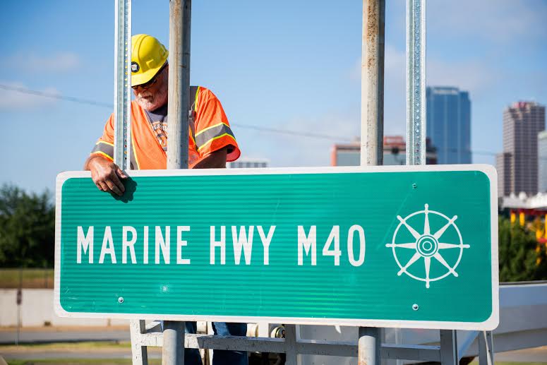
The last sign marking the McClellan-Kerr Arkansas River Navigation System (MKARNS) as one of two Marine Highway Corridors in the state was installed earlier this week on the Main Street Bridge that connects the cities of Little Rock and North Little Rock, according to Arkansas State Highway and Transportation Department (AHTD) officials.
In August 2015, U.S. Secretary of Transportation Anthony Foxx designated the MKARNS as a Marine Corridor – a move that illustrates the U.S. DOT’s support for further incorporating marine highway services on the MKARNS as an important component of the national and regional freight transportation systems.
Arkansas is one of 37 states with navigable waterways and the MKARNS is the second Marine Highway noted on the state’s highway system. See attached map depicting locations of installed signs. The other Marine Highway noted is the Mississippi River.
The MKARNS is a 445-mile waterway that starts in Oklahoma and crosses through Arkansas to reach the Mississippi River and ultimately ends in the Gulf of Mexico. A system of ports along this waterway is crucial to local, state and regional economies.
The MKARNS had a nearly eight percent increase in freight shipments in the past two years, and the 2015 tonnage in both Arkansas and Oklahoma totaled nearly 10 million tons with a value of nearly $4 billion.
Not only is the MKARNS an economic force in Arkansas but it also relieves the roadway of a significant amount of traffic. A single barge can transport the equivalent of 60 large commercial vehicles and that significantly reduces the amount of wear and tear done to Arkansas’ highways.